Imagine, if you will, a mosaic.
Continue reading Mosaics, Metaphors, Monuments: Hochelaga Rock in Imaginary Perspective
Imagine, if you will, a mosaic.
Continue reading Mosaics, Metaphors, Monuments: Hochelaga Rock in Imaginary Perspective
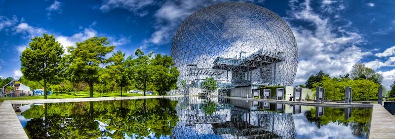
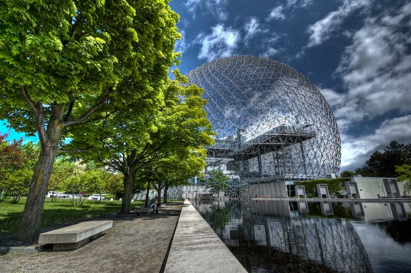
The biosphere is a unique and spectacular institution on the St-Helen island at the Jean-Drapeau park. Its massive ‘golf ball’ structure thathoused the American Pavillon during the Expo 67, was designed by the architect Buckminster Fuller.
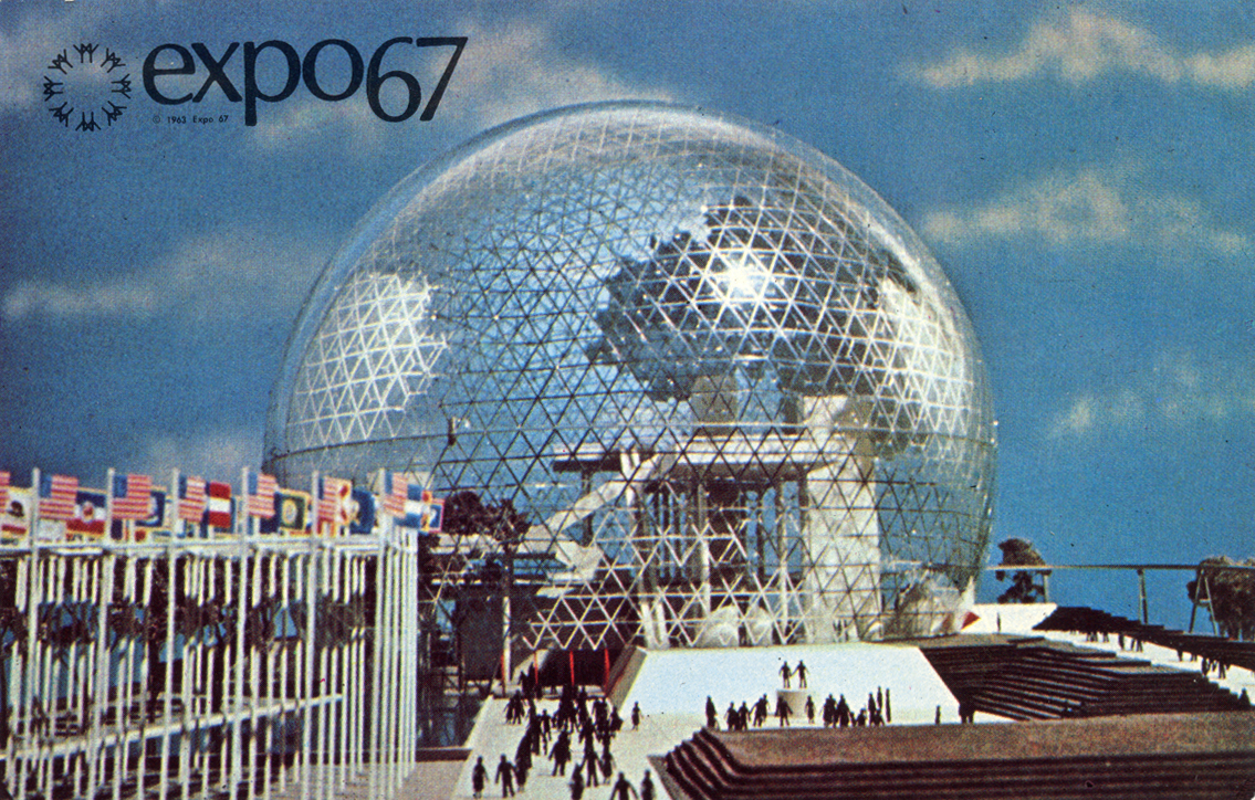
The biosphere proposes a variety of expositions to educate its visitors about various environmental issues. For instance, the main focus is on climatic change, biodiversity, sustainable development, the quality of air and water and more. These subjects of concern should be regarded with great importance in Canada. The environmental state of the world is at a critical point and people need to know and act upon these facts to change the devastating path of pollution. Unfortunately, the biosphere is the only museum of the sort in North America and it hardly has any visibility.
Our main goal is to increase the growth and importance of the Biosphere by promoting it on social media and by raising environmental awareness. This institution is neglected and should have greater visibility given it is the only museum in North America that discusses the environment.
The old Lachine is celebrated for the beauty of its historical buildings and of the natural landscape at the end of the St-Louis Lake and the beginning of the rapids. For this post, I concentrated my efforts in highlighting the fact that Lachine, one of the boroughs of the west of the city of Montreal, was constructed and populated with different activities relying on colonial relations primarily with Indigenous people.
Contact:
The western history of what we now call Lachine starts with travels of Jacques Cartier (1535) and Samuel de Champlain (1603). The main feature of the territory for both explorers is the terrible rapids that block the route towards the West. The Grand Sault, as Cartier calls it, or the Sault Saint-Louis for Champlain, is a critical landmark for both Europeans and Indigenous people.
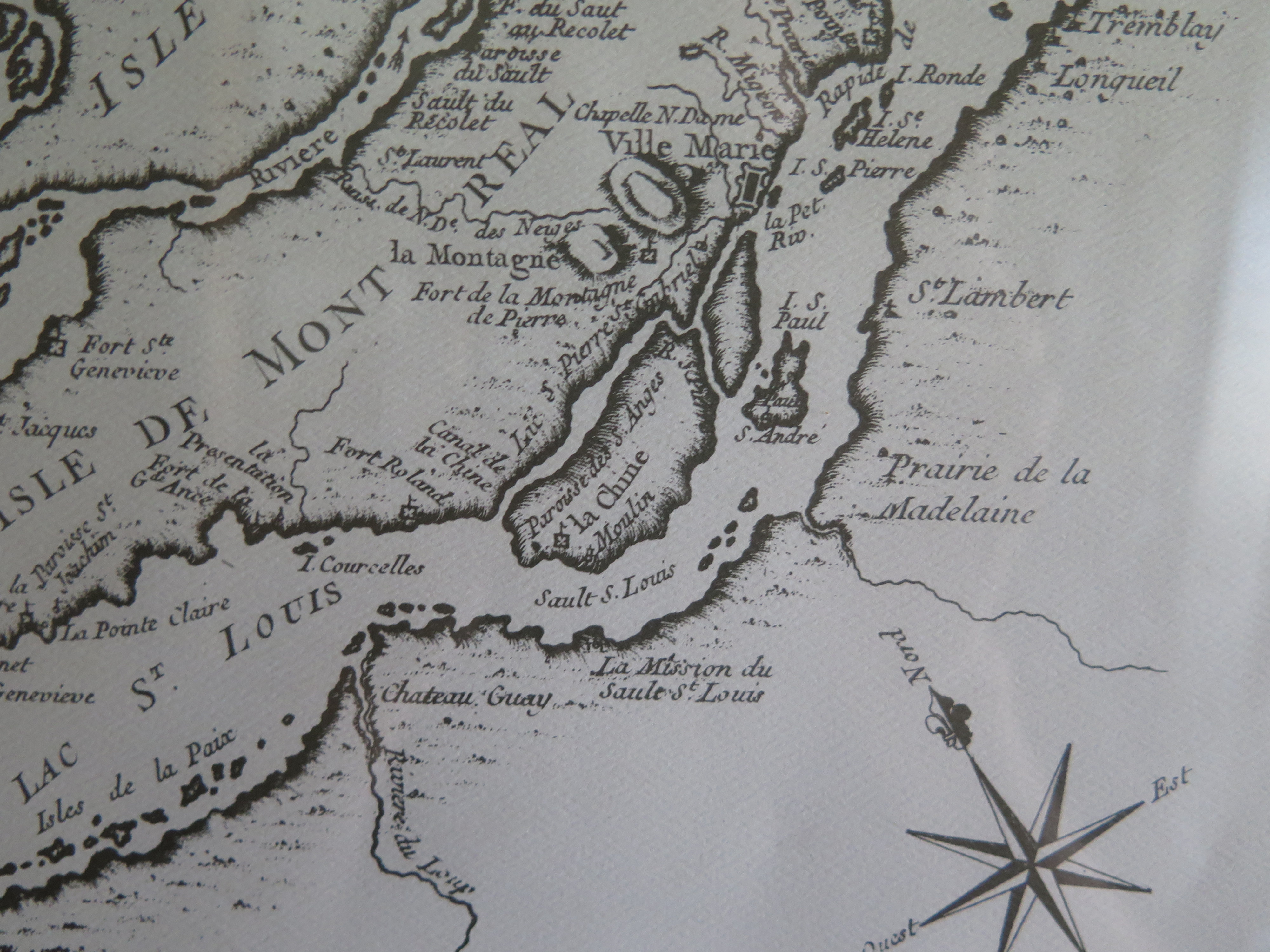
The most western point of those rapids, the site of my interest in this work, rapidly becomes a privileged point of meeting for colonizers and their commercial partners. This point is crucial for strategical reasons. What archeologists call site BiFk-6 is a hill at the confluent of the Saint-Pierre River, the rapids and the Saint-Louis Lake that is easily recognisable, thus ideal as a commercial point. Indigenous people knew of this site long before Champlain dreamt of using it. Artifacts predating by more than 400 years the arrival of Cartier were found on the hill (Buteau and Chevrier 2001, 16).
Another proof of the use of this site pre-contact comes from Champlain. In the accounts of his travels, the 4th to be exact (1613), Champlain, through a conversation with Tessouat, chief of the Kichesipirini, delivers some crucial information about the status of the future Lachine. Speaking with his host on L’Ile-aux-allumettes at the modern-day border of Quebec and Ontario, he asks why does his people try to cultivate such an inhospitable land while better lands like the one near the Sault Saint-Louis were “deserted and abandoned”. Tessouat answers that the unattractiveness of his lands makes it safer to live on and that if the French were to build a fortification, as they promised, he would consider moving there, assured that his enemies would not attack (Champlain 1908, 191). From this exert, we can understand that this land was known outside of the Iroquoians to which the Island of Montreal is usually associated to since the Kichesipirini passed through.
Name:
I also want to underline that colonial history is also topographical and connected to the writings of the colonial power. The oldest name we know today for the site I am investigating was given by Europeans. I was unable with my research to find the name used by any Nation to designate Lachine. Prior to its modern name, Lachine had been called Sault Saint-Louis in correspondence to the rapids and then Côte Saint-Sulpice in honor of the religious group, the Sulpician, who had claimed the Island of Montreal as theirs. The name Lachine alludes to another aspect of the colonial history of the Americas. As we all know, Europeans set sail westward I hopes of finding China through the sea since the Ottoman had taken control of Constantinople. Even after finding North America and acknowledging that it was not Asia, some explorers were still obsessed with finding the route to China. It is the case of Robert Cavelier de LaSalle who obtained the Seigneurie from the Sulpician. His many travels down the Mississippi in hopes of finding China were becoming so famously a failure that the settlers on his lands began to call the Seigneurie La Chine (literally China) to mock the explorer. The name then becomes another embodiment of the commercial colonialism of the Europeans.
Lachine Massacre:
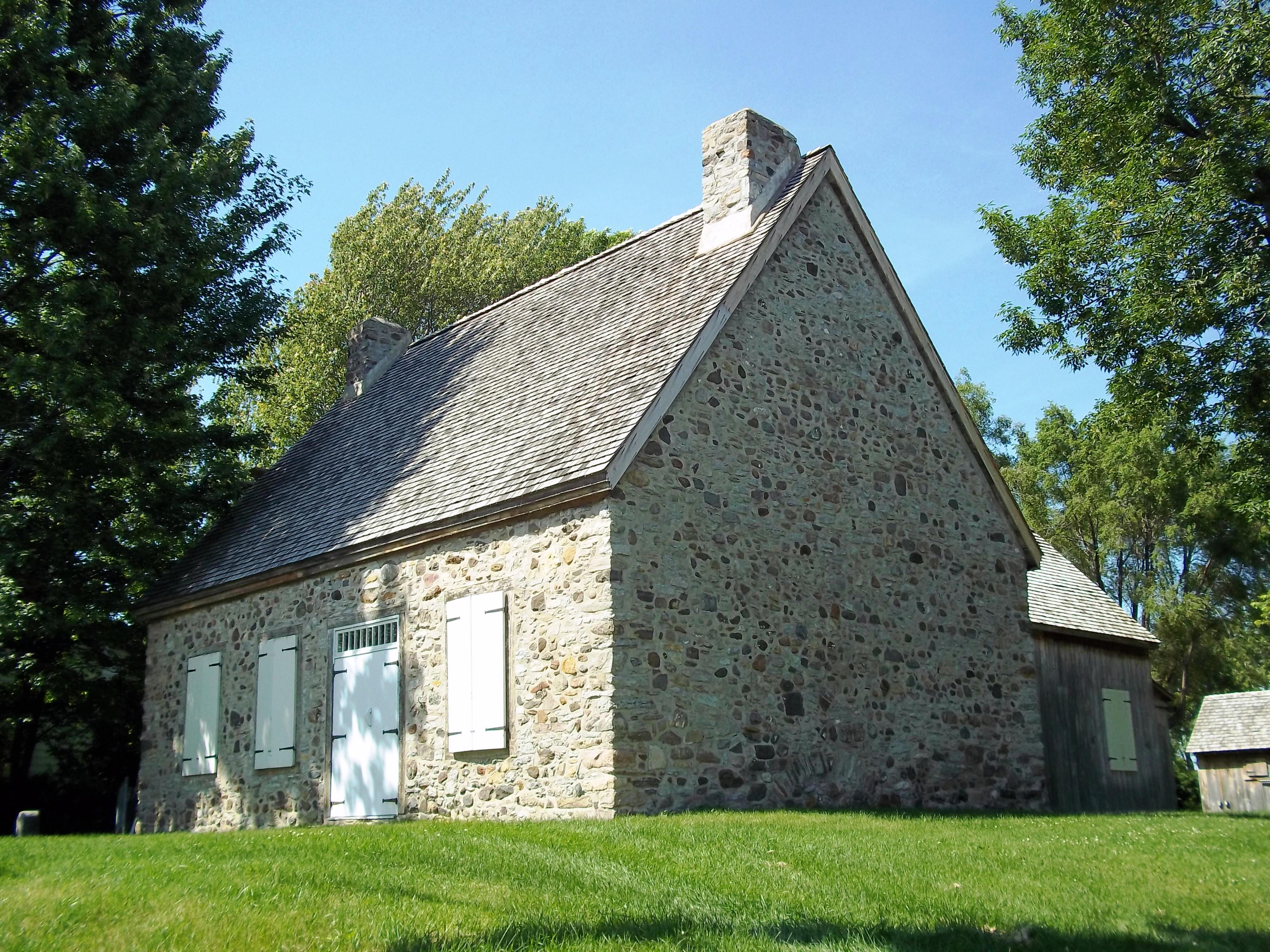
While Lachine started as a meeting point between the French and the Algonquin people, it rapidly became a settler village as I just mentioned, the first arriving in 1667. The Seigneurie consisted in three fortification of wood across a territory that spanned from the modern day border of Pointe-Claire and Dorval to the one between LaSalle and Verdun. In 1689 happened an event that became a deep traumatic experience for the people of Lachine. The memory of this event carried on into the 20th century. The commission of the historical site and monuments of Canada erected in 1935 a small monument with a plaque to commemorate this tragic event. On it can be read information taken from a letter of Governor Frontenac reporting that in the dead of night, Iroquois warriors attacked and burned all the residences of the Lachine Seigneurie killing 200 people and abducting 120 (Parkman 2005, 113).

This plaque is problematic in many ways. What this monument and Frontenac fail to say is that the reality was closer to 24 deaths and 60 prisoners and that this attack (Moussette 1978, 44). Also, this event occurred in the context of the French and Iroquois wars encouraged by the British. If French settlers and authorities were allied to the Algonquin, the British were allied to the Iroquois. A peace treaty signed between the French and the Iroquois in 1667 calmed the relations in New France for 20 years. The situation deteriorated following two events. The first one occurred in 1687. At the demand of a new Naval Minister in France, the Governor of New France broke the peace and prepared a trap for the Onnontagués Iroquois by inviting them to some festivities at Fort Frontenac where they were imprisoned and some sent to the King’s galleys (Moussette 1978, 44). The other event is the Glorious Revolution in England that chased James II, ally of Louis XIV, shifting the relation with France in Europe and in America. In short, the attack on Lachine was not an act of pure cruelty but a response to a direct attack on a part of the Haudenosaunee Confederation and it was encouraged by a change in alliances. Factual information is not the only problem about this plaque. Two medallions are decorating the upper part on the right depicting men working in what looks like a dock and the other on the right depicts “Indians” in the wood, naked except for the feathers on their head looking at a 17th century ship on a river that we guess is the St. Lawrence.
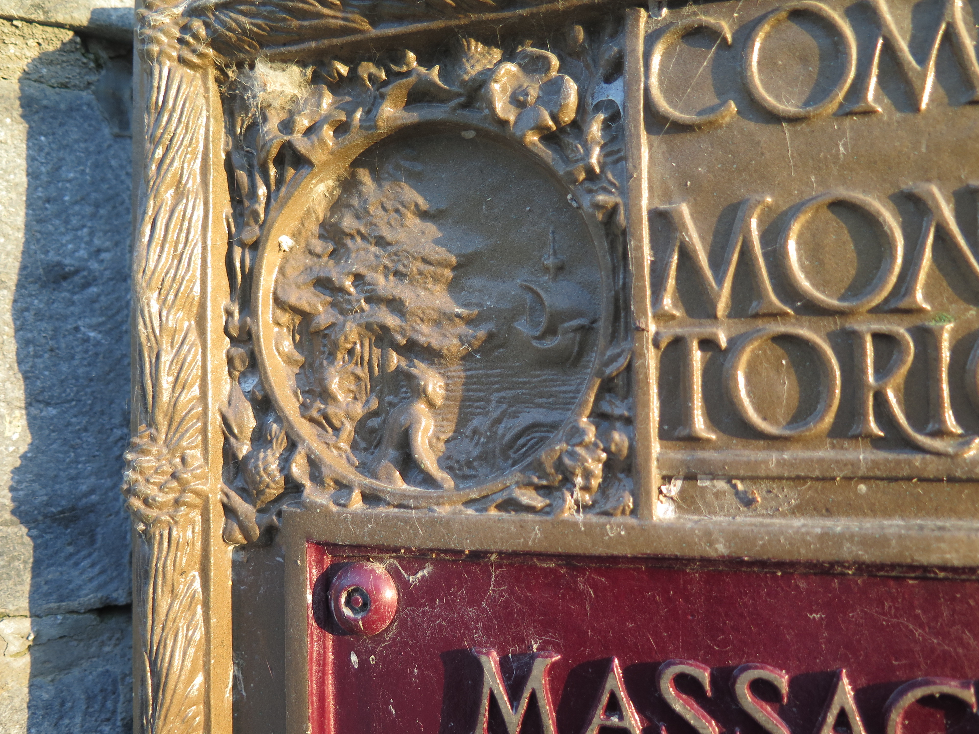
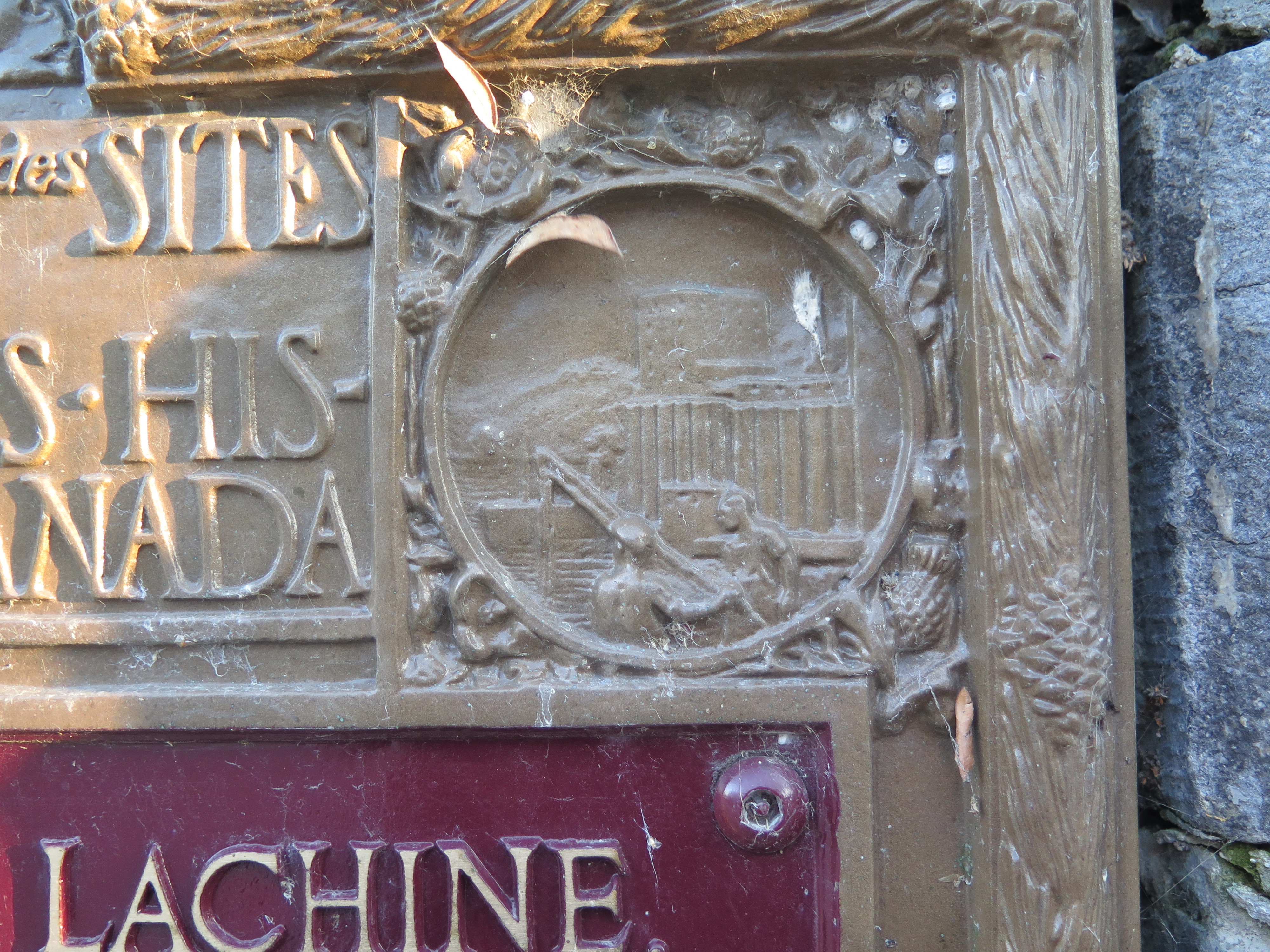
This representation is problematic like many others we seen in America because it reinforces this opposition between Nature and Culture, present and past. It also creates a devise that is particular to Lachine. Because of the context of the Lachine Massacre, we assume the Indigenous men we are seeing are Iroquois and because of Kahnawà:ke being so near, we associate them more precisely with Mohawks. This association is dangerous because it damages the relationships between modern day settler descendants and Mohawk people. The medallion depicts these men of the 17th century looking at the other side of the river creating this image that Mohawk people are still in this “primitive state” and that they are still a threat to the inhabitant of the other side of the river.
Fur trade official site:
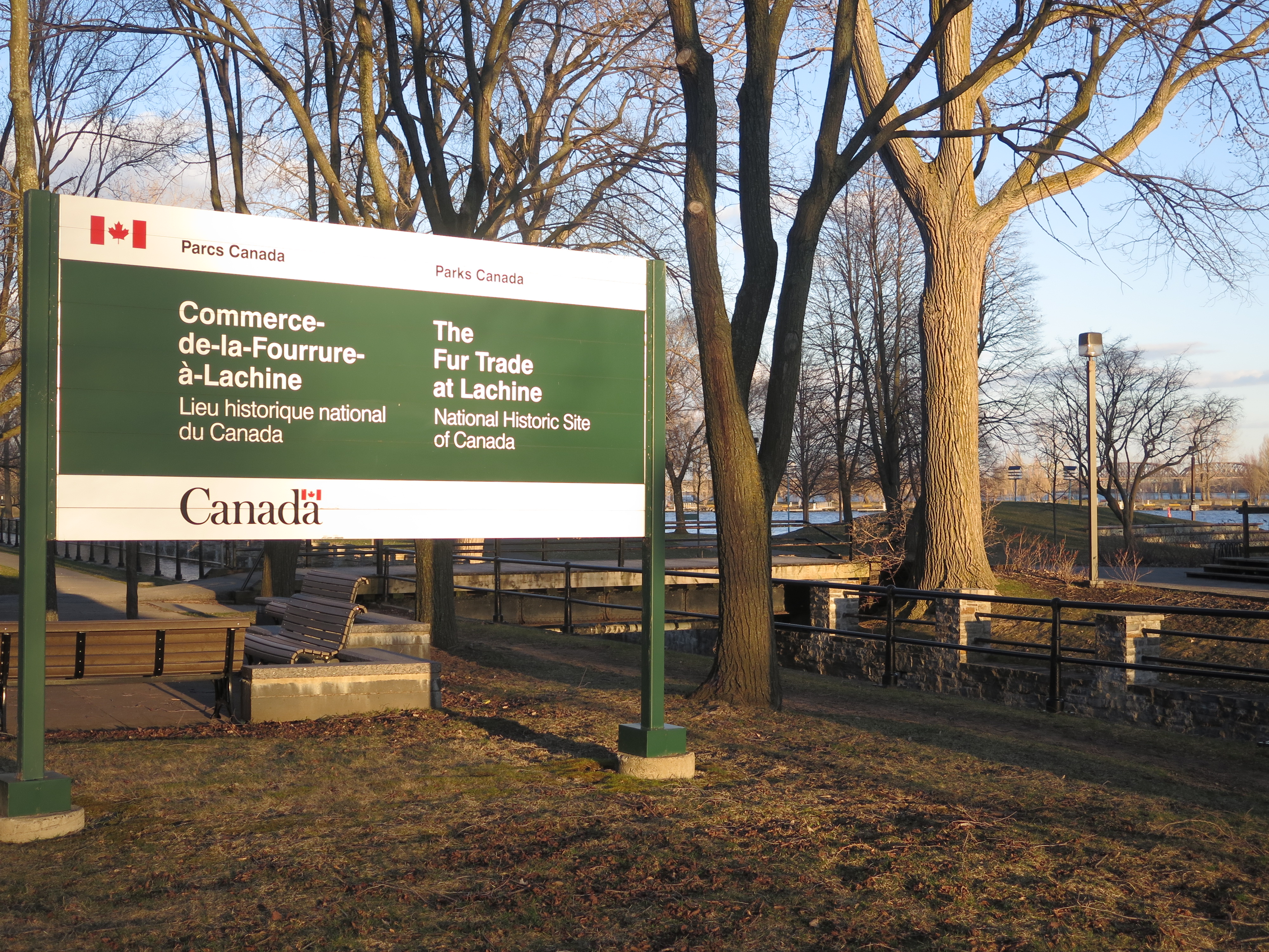
As a transitionary space between the St. Lawrence valley and the Pays d’en haut, Lachine quickly became a pivotal point in the fur trade. Already a key geographical point in the meeting between French and Algonquin, it became an official commercial point with the construction of a hangar by the North West company in 1803.
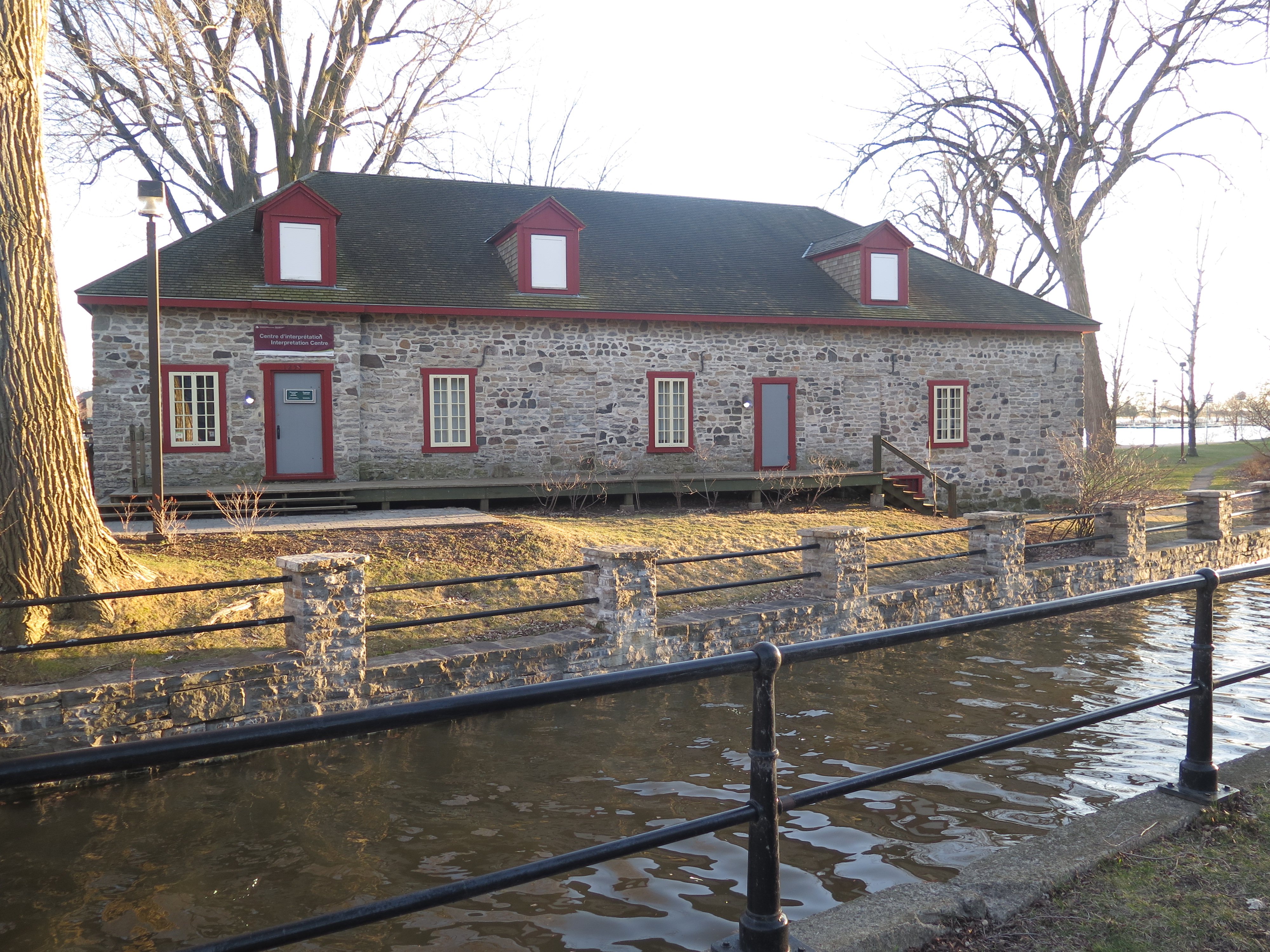
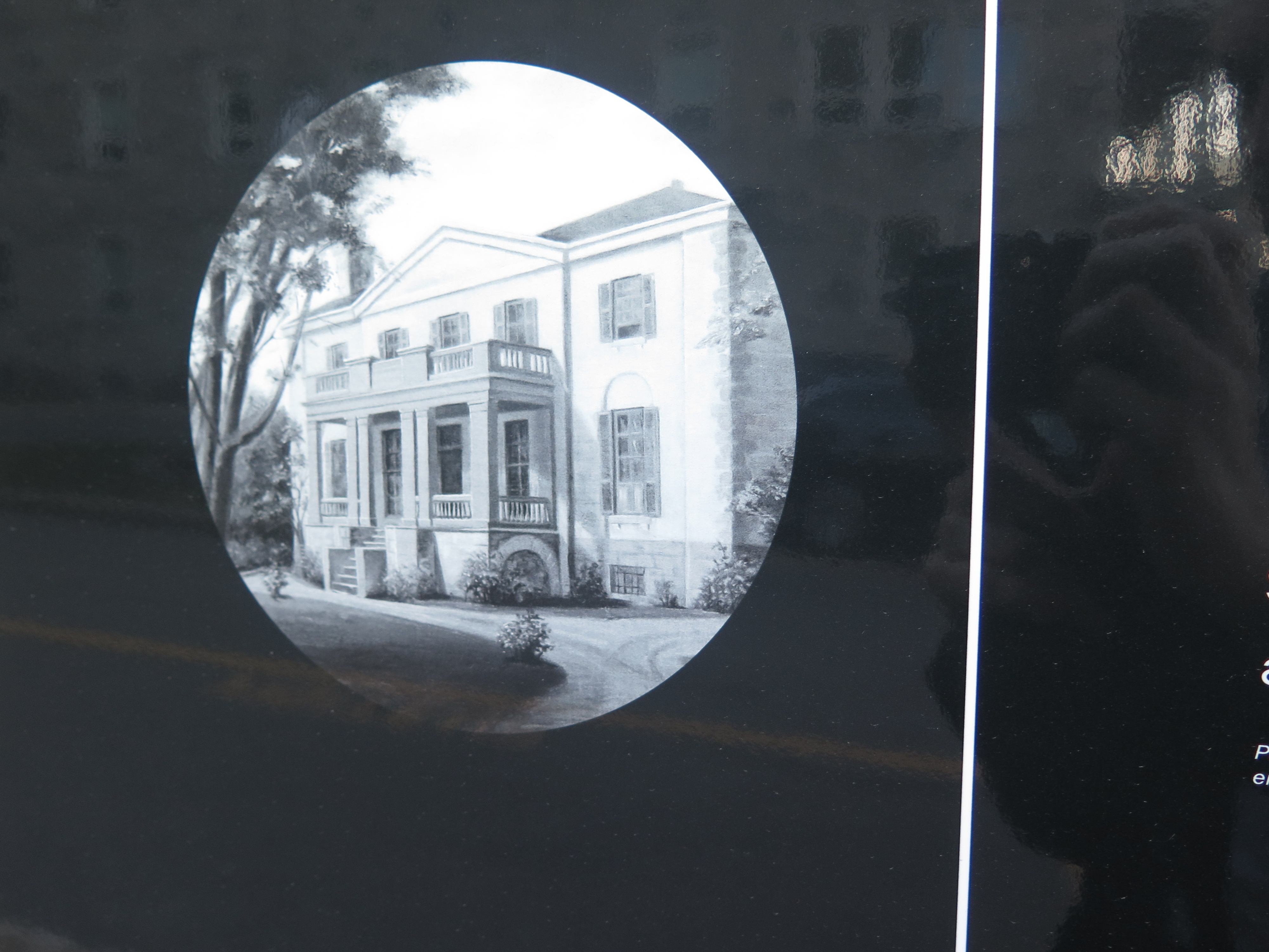
The economy of the small village relied on the fur trade. Taverns and hostels were built to accommodate the travelers who would come and go with the seasons. The competition raged between the Scottish North West Company and the English Hudson Bay Company. Following the annexation of the NWC by the HBC in 1821, Sir George Simpson, General Governor of the HBC, built a mansion in Lachine to assess his power over the fur trade. Rarely present in this residence, he left the manor to his second, Edward Hopkins and his wife the painter Frances Ann Hopkins. Thanks to her depictions of the fur trade, we know that indigenous people stayed an important part of the commerce well into the 19th century. As a side note, it is in this Manor that the Hopkins and Sir Simpson received the Prince of Whales in 1860.
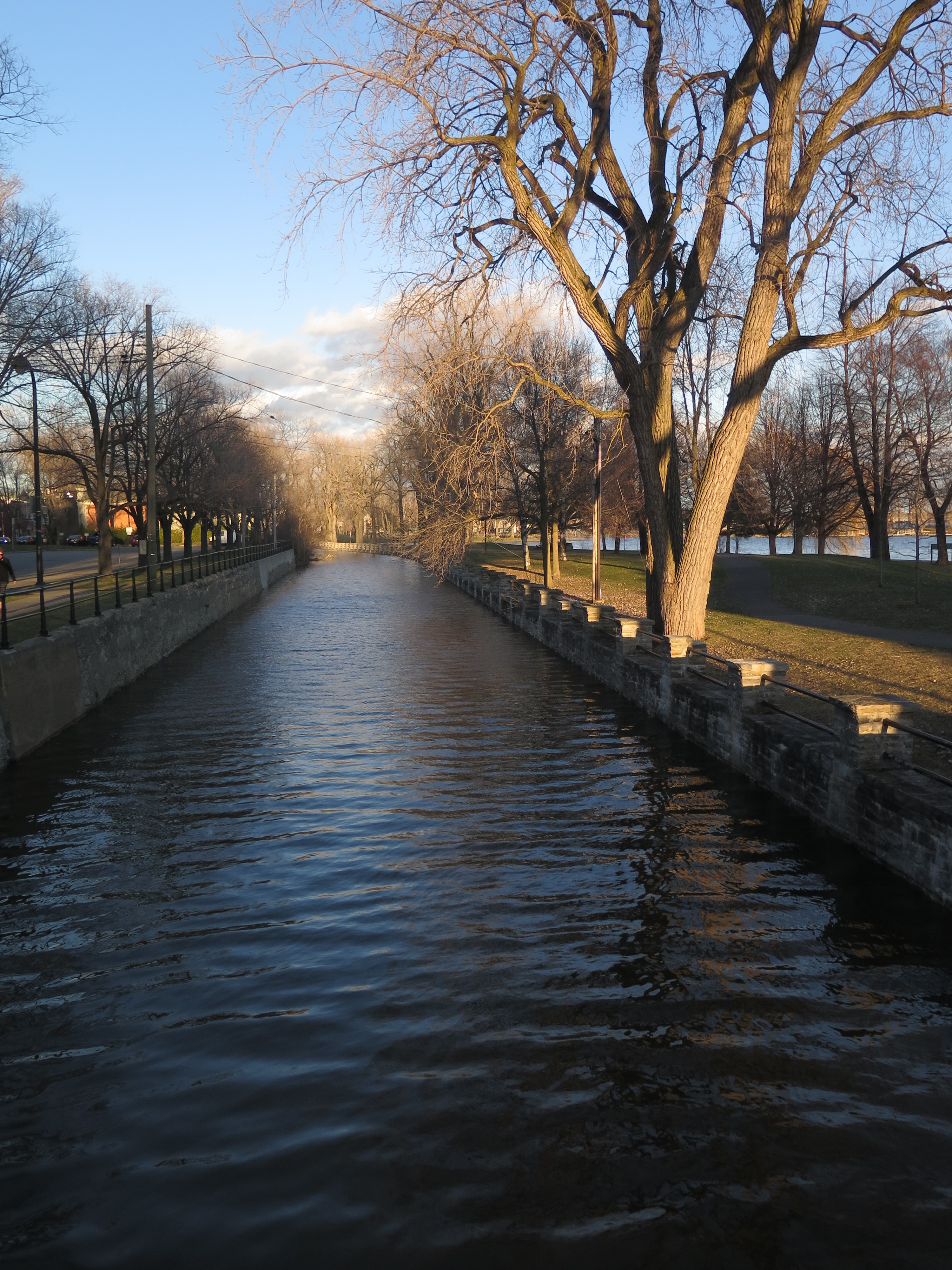
Lachine Canal:
Between the manor and the hangar lies the Lachine Canal dug between 1821 and 1825, then enlarged from 1843 to 1848. As the 19th century progressed, the economy of the canal passed from fur to industrial goods. One of those resources passing through was sugar coming from the Caribbean. Ending in the Redpath refinery in Pointe-Saint-Charles or in the molasses factory in Faubourg à m’lasse, it is important to mention that Canada passed from a resource colony to an actor in economical colonialism outside of its borders.
Missionary site:
At the death of Sir George Simpson, Les Soeurs de Sainte-Anne, a religious order founded in 1850 in Vaudreuil, bought the manor and used it as a convent and as an all-female boarding school. The establishment of this group in what we call today the Old Lachine was the start of the population movement from the rural areas around the Seigneurie towards a “downtown” Lachine.
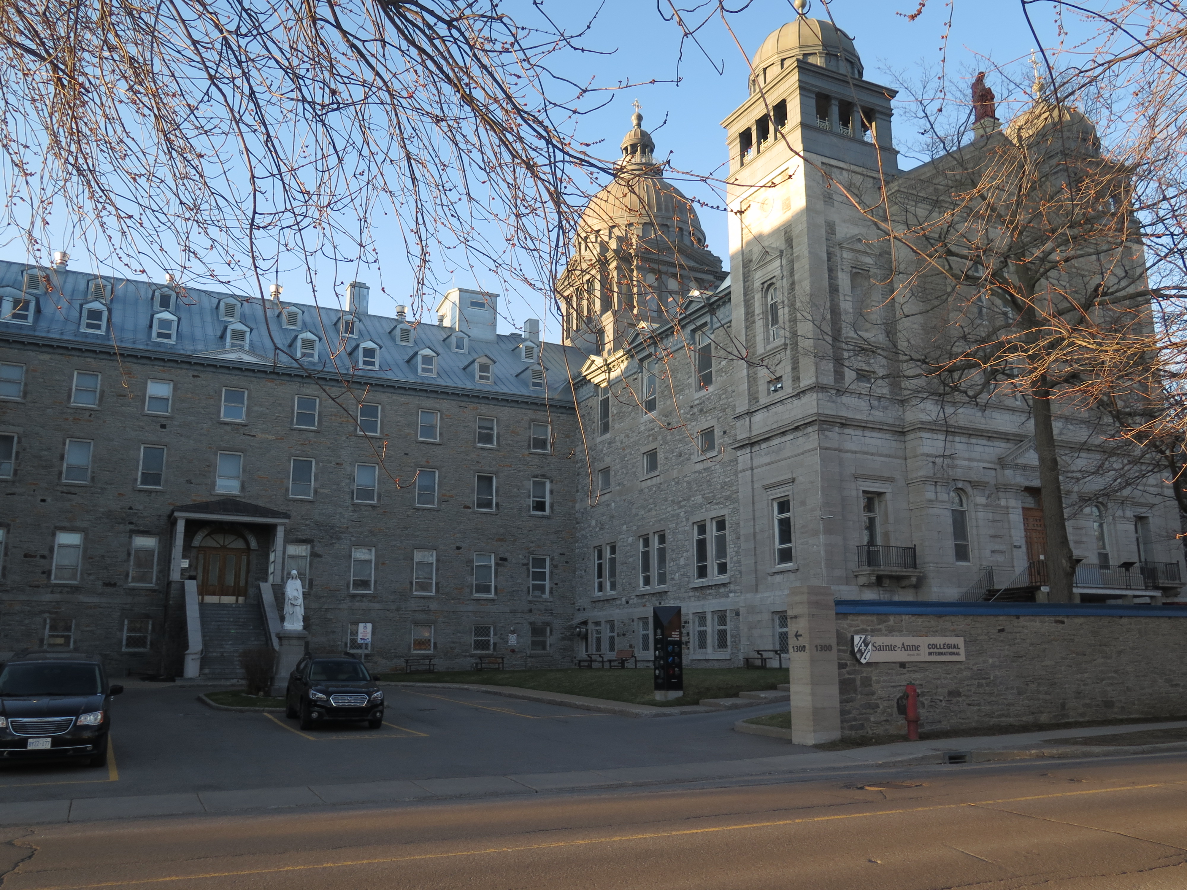
It is also from this Mother-house that Sisters left on evangelisation missions to British Columbia (1858), U.S.A. (1867), Alaska (1886), Japan (1934), Haiti (1944), Chile (1965) and Cameroun (1968). In Canada, the sisters established schools in Quebec and BC. Arriving in Vancouver in 1858, they were the first missionaries in the West and participated to the establishment of the first schools and hospitals. Their involvement in the education of the indigenous youth was inscribed in the evangelisation frame that has characterised the history of education in Canada but they took great pride in giving good education to white and indigenous girls in B.C. Later, with the Indian Act, they participated in two schools that were part of the Residential school system, one of them being in Kamloops (TRC 2016, 692). In parallel, they continued to give classes in non residential schools in B.C. and Quebec.
In conclusion, my goal was not to only show the darker sides of the history of Lachine but to try to write a nuanced version of a history that is usually euro-centric. Only by knowing and understanding the imbalances in the colonial power can we hope to decolonize the relationships we have with the first people and non-western immigrants.
Bibliography:
Buteau, Hélène and Daniel Chevrier. 2001. D’audace en mémoire : Le lieu dit Lachine, un regard archéologique, Collection In Situ. Montréal : Art Gestion Inc.
De Champlain, Samuel. 1908. Les Voyages de Samuel de Champlain au Canada 1603-1618. Québec: Édition populaire.
De Champlain, Samuel. 2009. À la rencontre des Algonquins et des Hurons 1612-1619. text in modern french annotated and presented by Éric Thierry. Collection V. Québec : Éditions du Septentrion.
Moussette, Normand. 1978. En ces lieux que l’on nomma “La Chine”…. Lachine : Ville de Lachine.
Parkman, Francis. 2005. Count Frontenac and New France under Louis XIV. Raleigh: Hayes Barton Press.
Truth and Reconciliation Commission of Canada. 2016. Canada’s Residential Schools : The History, Part 1, Origins to 1939. Montreal; Kingston : McGill-Queen’s Press.
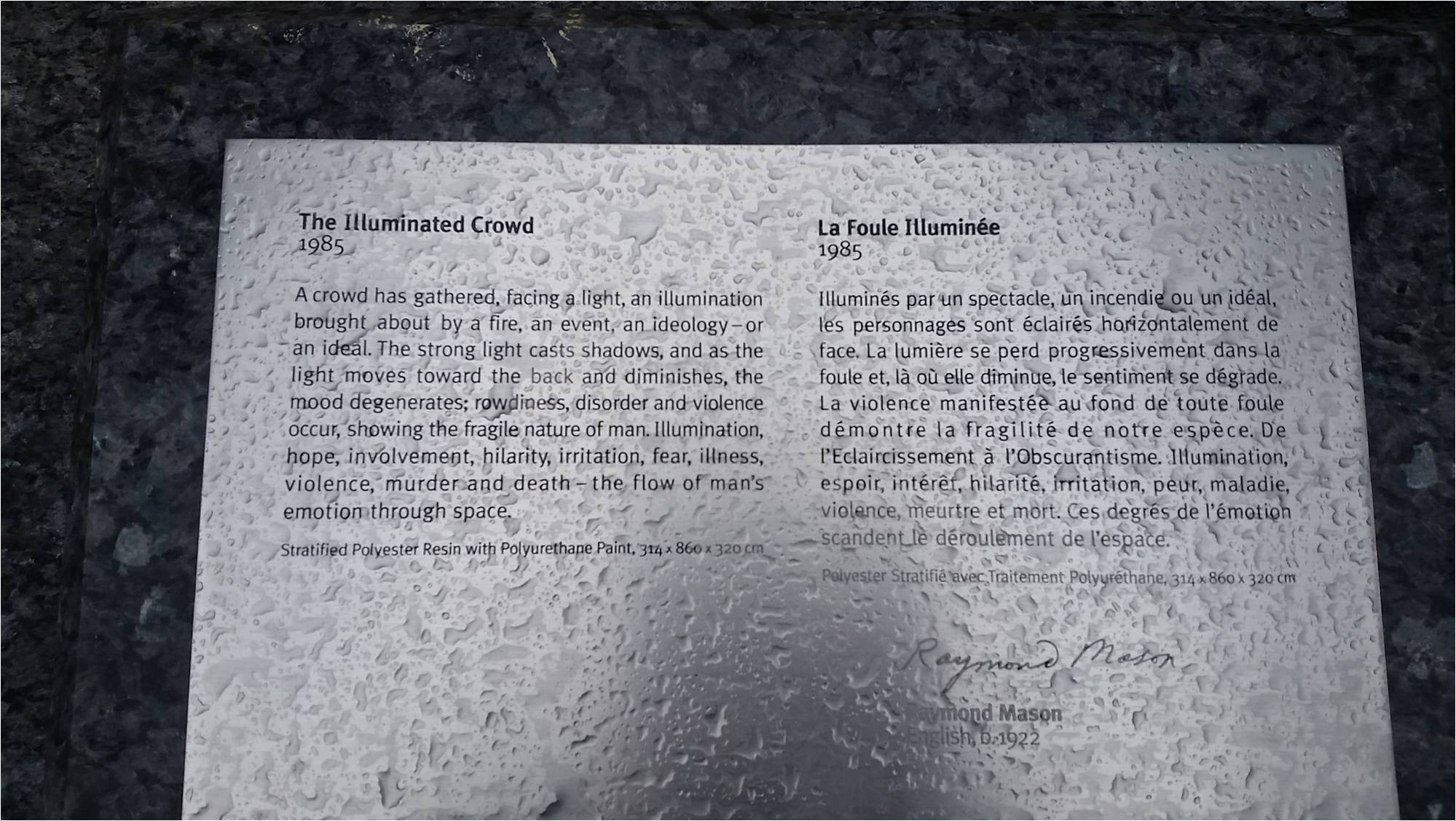
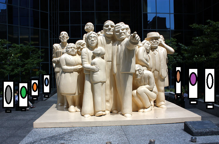
The Illuminated Crowd is a sculpture located in downtown Montreal on rue McGill College created by Raymond Mason and erected in 1985. The statue is a bigoted piece that represents the ideology of western triumphalism and how those who don’t fall into that ideology are left behind and minimalized. The statue presents the literal light of the west as all powerful and that the farther away from the light you are the worse off you are, presenting those worse off as grotesque and the ones in the light as idealized westerners.
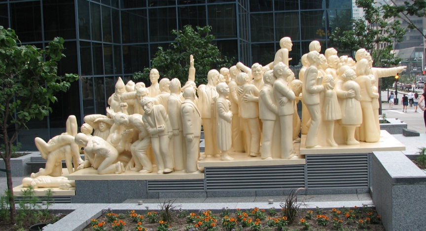 The intervention’s aims are to express silenced voices and combat ethnocentricity, engage and criticize the concepts of western culture and superiority. Additionally the hope is to remove focus from unsightly art.
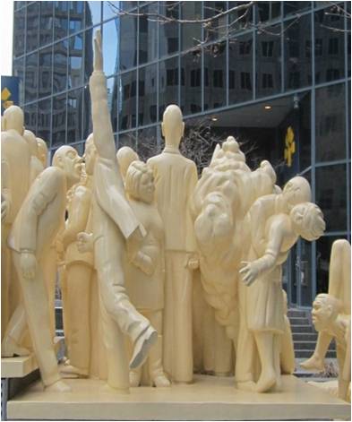
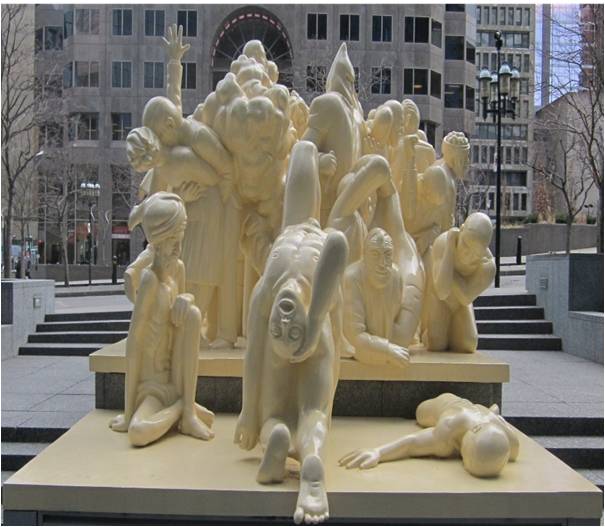
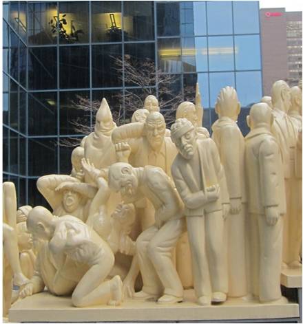
The intervention consists of creating a series of photographs and written stories that represent people from all over Montreal, aiming to represent people all walks of life. These photographs are to be placed on columns along the perimeter of the area, facing the statue, with small plaques telling the photos’ stories. By gathering people and their stories, we hope to combat the ideology of the statue, additionally the placement would remove focus from the statue.
George Wade’s monument of John A. Macdonald was created in 1895 and is located at Place du Canada. Monuments like Macdonald’s have recently struggled with different tensions between their intended symbolism and interpretation. There are discussions concerning the role they play and what they represent in today’s society. More pressingly, the vandalism or defiling of these sites reveals a material manifestation of this problematic that signals the irreconcilability of the essentialist version of history they embody and the histories of violence or injustice that are conveniently left out.

Continue reading Ahead of John A. MacDonald : Counter Narratives at Place du Canada
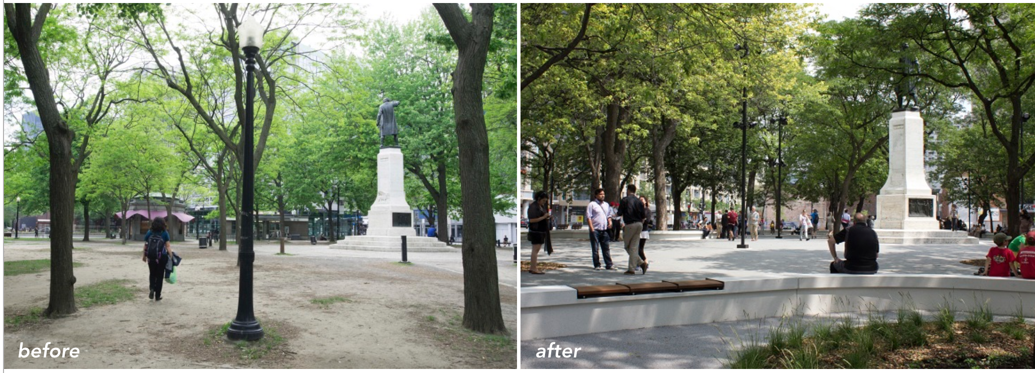
In 1870, Cabot Square was opened upon land gifted to the city from the Sulpicians. Initially, the space’s central feature was a fountain, but in 1935 a statue of explorer John Cabot – donated by the Italian community – replaced it.
The portrayal of Cabot is problematic; using tropes of monumental sculpture, it perpetuates a narrative of European explorers discovering a “new world”. Cabot’s image is thus meant to remind the viewer of the official version of Canadian nation-building, while marginalizing alternative perspectives; most notably those of Indigenous peoples.
Ironically enough, in the decades that followed Cabot Square became a gathering site for urban Indigenous peoples from across the country; the space is especially important to many homeless Indigenous of Montreal, who often lack the ability to articulate their identity in the urban setting due to both economic and symbolic disenfranchisement.
Recently, the municipal government enacted an urban renewal plan that led to the renovation of Cabot Square. The project included a permanent use for the building in the park, better lighting, the addition of garbage bins, and the paving of pathways, among other details. Importantly, the plan also included a permanent police presence through the stationing of a liaison officer in the area.
To facilitate this process, the city also launched the Montreal Urban Aboriginal Community Strategy (RÉSEAU). The organizations’ objectives were to present a portrait of Cabot Square from the point of view of the Indigenous community located there, as well as the development of solutions to improve safety and wellbeing through a “collaborative and coordinated approach”.
In practice, once the Square re-opened after many months of renovations, there were a few significant additions to it. The Indigenous-operated Roundhouse Café was opened in the rotunda on the west side, and 2 outreach workers now have an office on site. The space also began to host events such as International Indigenous Day celebrations and weekly soapstone carving workshops.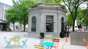
Notably, there is a tension evidenced by all these interventions; the planning policy of city had on one hand sought to “clean up” the park and focused its objectives in security terminology, while on the other hand devoted its resources to promoting a sense of community in the space.
The fact that the Cabot Statue—a symbol of colonial authority—should remain the central focus of the Square even after the renovation seems inconsistent with RÉSEAU’s goal of empowering Montreal’s Urban Indigenous community. The problem of a colonial monument presiding over a gathering space for Montreal’s dispossessed Indigenous peoples remains unaddressed. The intervention we have imagined engages with this problem, and aims to situate itself within and contribute to the outreach already being done in the space by advancing a discussion of the historical narratives present in Cabot Square.
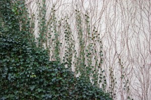
The first component of our proposed intervention is a community led planting of vines at the base of the Cabot monument. Over the course of a season, the vines would grow to form a living wall which would cover the statue entirely. Cabot’s figure would be obscured, but the form of the monument would remain in the landscape of the park, symbolizing a challenge to the authority of the historical narrative implicit in the statue. The aim of the living wall is to dispel the notion that any common or universal historical understanding is possible in a space as nuanced as Cabot Square, undoing the work of the State-sponsored colonial monument.
The second component of our intervention is a collection of oral testimonies, gathered from interviews with people who have lived and gathered in Cabot Square. The testimonies will be accessible online via smartphone, through a QR code that will be installed on a placard near the newly-covered monument. We will employ existing community networks such as RÉSEAU to seek participants. The audio component emphasizes the importance of oral tradition, suggesting a continued detachment from authoritative knowledge systems. A central theme of our intervention is the deference of historical authority to a living voice within the Montreal Indigenous community, and as such we will allow their testimony and narratives to shape our project, including whatever broader questions of colonial relations it might imply.